Argos
Scale your vector data creation. Argos uses deep learning to extract features from aerial and satellite imagery, giving your GIS team a massive head start on mapping projects.
How it works
Upload imagery, select features, and export GIS-ready vectors.
Input
Any Imagery
Compatible with Orthophotos, Satellite Imagery, and Drone maps. Supports common formats like ECW, TIFF, and JPG2000.
Detect
AI Extraction
Select what you want to find: Buildings, Solar Panels, Pools, or Trees. Our models process the raster data.
Validate
Human-in-the-loop
Review detections with confidence scores. Quickly accept, reject, or refine geometries before export.
Export
GIS Ready
Download clean Shapefiles, GeoJSON, or file geodatabases ready for ArcGIS Pro or QGIS.
Use Cases
- Urban Footprint Mapping
- Impervious Surface Analysis
- Solar Potential Surveys
- Vegetation Encroachment
- Property Tax Assessment
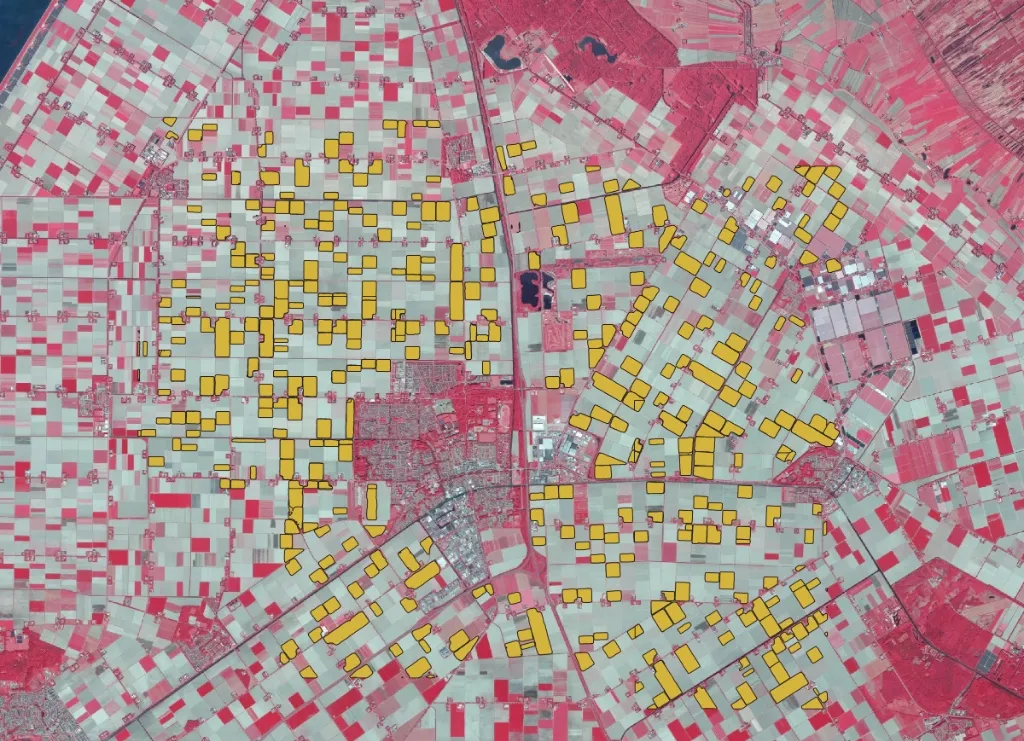
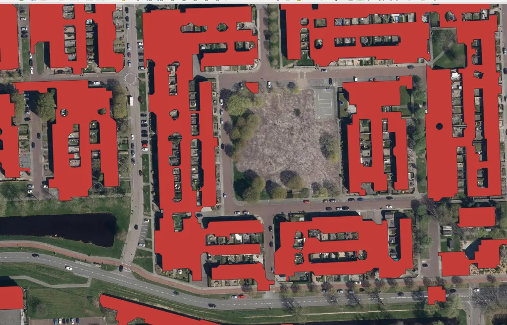
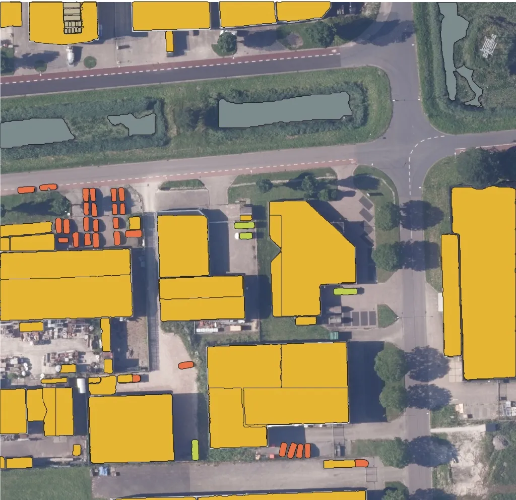
Extraction Gallery
High-precision vectorization from raster data.
Feature Extraction
Identify complex features in rural environments.
Urban Planning
Map city infrastructure at scale.
Building Footprints
Precise boundary detection for cadastro.
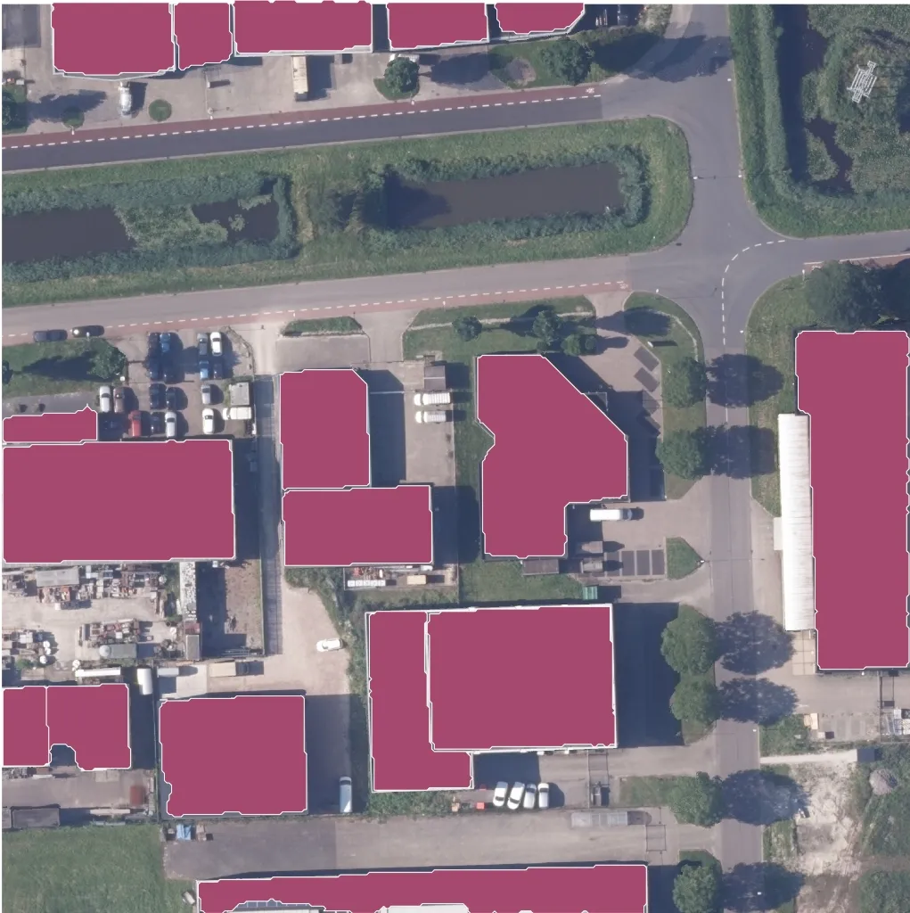
Industrial Zoning
Categorize land use types automatically.
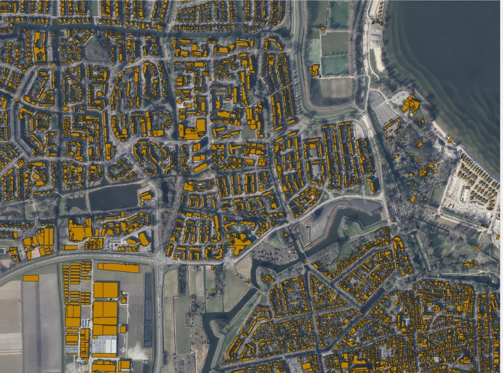
City-wide Analysis
Scale extraction to entire municipalities.
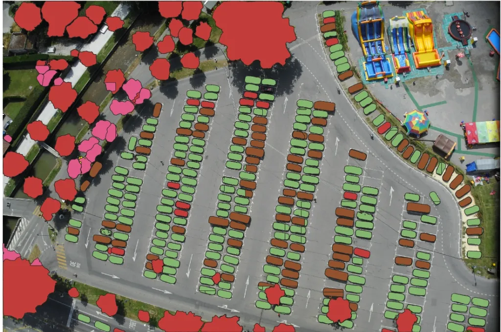
Parking Lot Analysis
Semantic segmentation of parking areas.
Vehicle Detection
Automated car counting and occupancy.
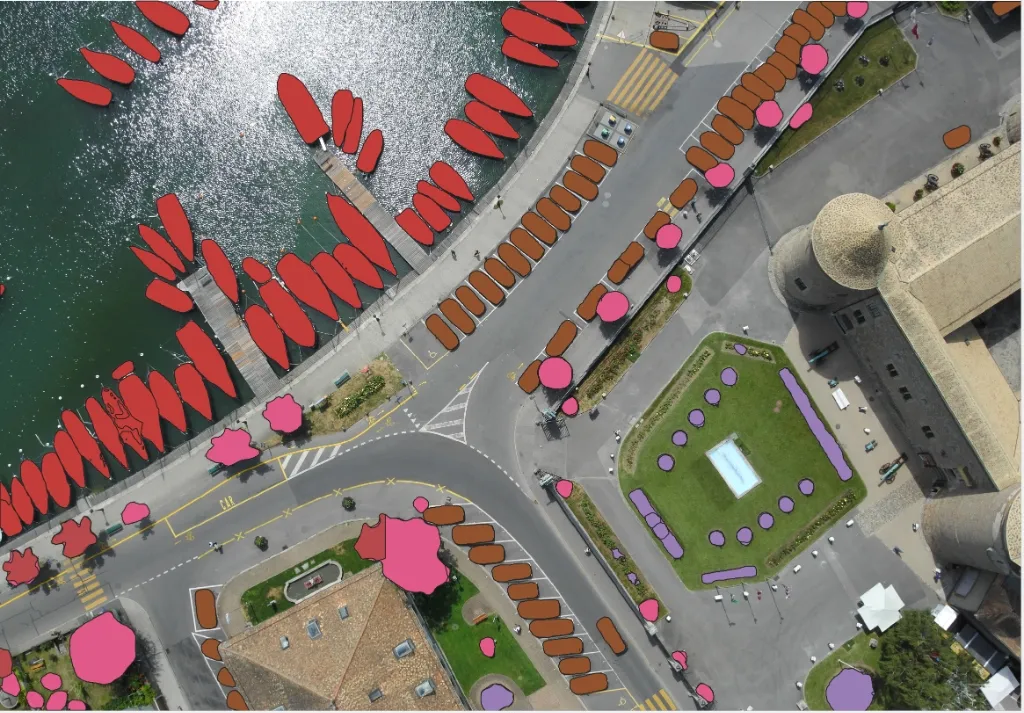
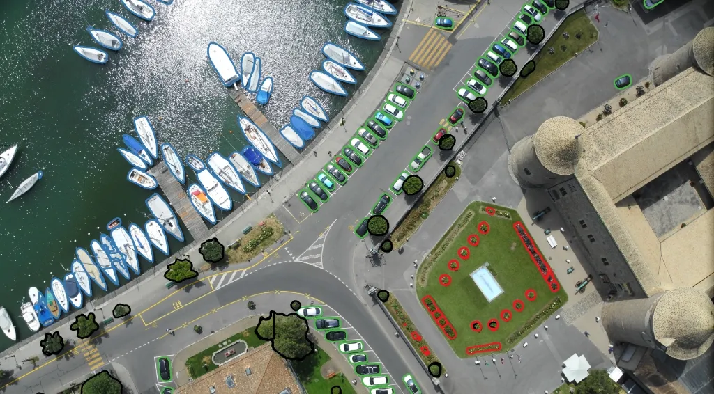
Marina Management
Vessel detection and classification.
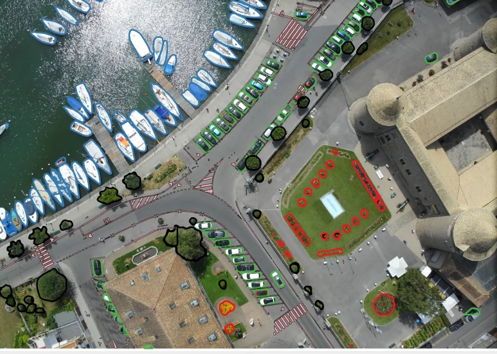
Waterfront Zoning
Precise segmentation of marina infrastructure.
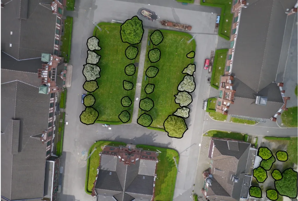
Urban Vegetation
Tree canopy mapping and green space analysis.
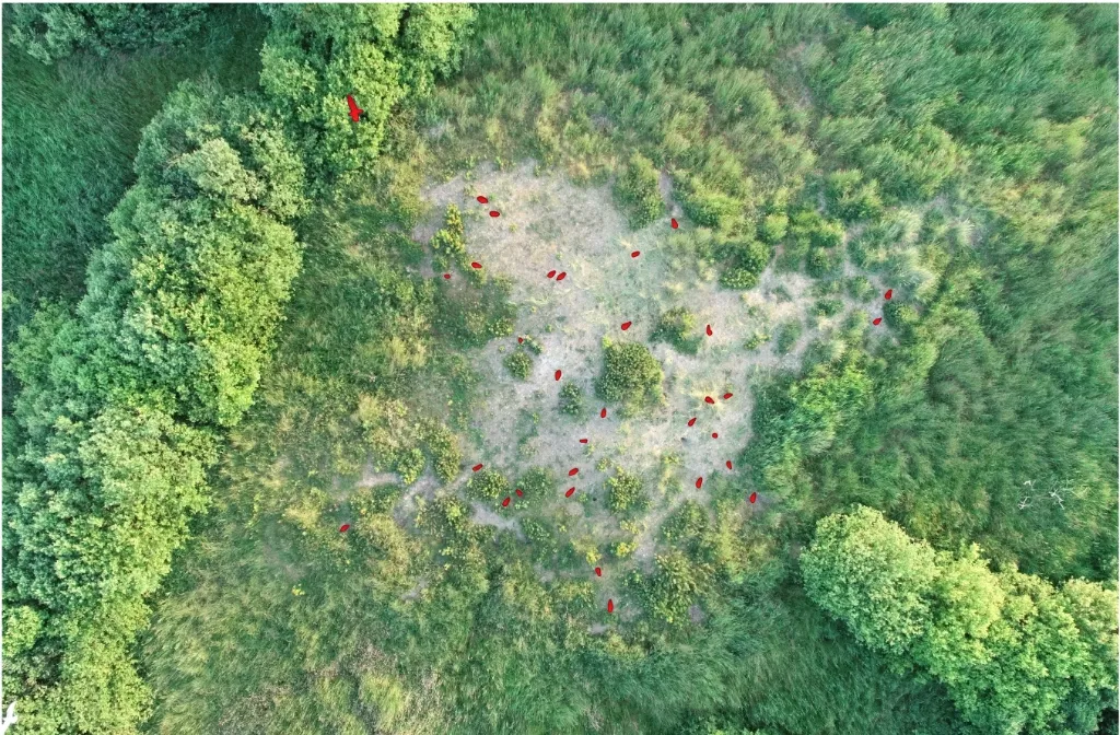
Wildlife Monitoring
Aerial bird population surveys.